


| Pangong Tso | |
|---|---|

Pangong Tso
|
|
| Location | Ladakh, Jammu and Kashmir, India; Rutog County, Tibet, China |
| Coordinates | 33°43′04.59″N78°53′48.48″ECoordinates: 33°43′04.59″N 78°53′48.48″E |
| Type | Soda lake dimictic lake(east basin)[1] cold monomictic lake(west basin)[2] |
| Basin countries | China, India |
| Max. length | 134 km (83 mi) |
| Max. width | 5 km (3.1 mi) |
| Surface area | approx. 700 km2 (270 sq mi) |
| Max. depth | 328 ft. (100 m) |
| Surface elevation | 4,250 metres (13,940 ft) |
| Frozen | during winter |


| Pangong Tso | |||
| Traditional Chinese | 班公錯 | ||
|---|---|---|---|
| Simplified Chinese | 班公错 | ||
|
|||
|
|||
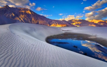
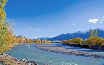
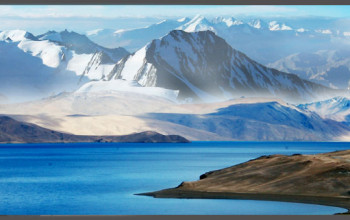
Pangong Tso (Tibetan: སྤང་གོང་མཚོ, Wylie: spang gong mtsho; Hindi: पांगोंग त्सो; Chinese: 班公错; pinyin: Bāngōng Cuò), Tibetan for "high grassland lake", also referred to as Pangong Lake, is an endorheic lake in the Himalayas situated at a height of about 4,350 m (14,270 ft). It is 134 km (83 mi) long and extends from India to China. Approximately 60% of the length of the lake lies in China. The lake is 5 km (3.1 mi) wide at its broadest point. All together it covers 604 km2. During winter the lake freezes completely, despite being saline water. It is not a part of Indus river basin area and geographically a separate land locked river basin.[3]
The lake is in the process of being identified under the Ramsar Convention as a wetland of international importance. This will be the first trans-boundary wetland in South Asia under the convention.
Sino-Indian border dispute[edit]
Pangong Tso is in disputed territory. The Line of Actual Control passes through the lake. A section of the lake approximately 20 km east from the Line of Actual Control is controlled by China but claimed by India. The eastern end of the lake is in Tibet. After the mid-19th century, Pangong Tso was at the southern end of Johnson Line, an early attempt at demarcation between India and China in the Aksai Chin region.
The Khurnak Fort lies on the northern bank of the lake, halfway of Pangong Tso.[4] The Chinese has controlled the Khurnak Fort area since 1952.[5][6] To the south is the smaller Spanggur Tso lake.
On October 20, 1962, Pangong Tso saw military action during the Sino-Indian War, successful for the Communist People's Liberation Army.[7]
Pangong Tso is still a delicate border point along the Line of Actual Control.[8][9] Incursions from the Chinese side are common.[10]
Flora, fauna and geography[edit]
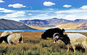
The brackish water[11] of the lake has very low micro-vegetation. Guides report that there are no fish or other aquatic life in the lake, except for some small crustaceans. On the other hand, visitors see numerous ducks and gulls over and on the lake surface. There are some species of scrub and perennial herbs that grow in the marshes around the lake.
The lake acts as an important breeding ground for a variety of birds including a number of migratory birds. During summer, the Bar-headed goose and Brahmini ducks are commonly seen here. The region around the lake supports a number of species of wildlife including the kiang and the Marmot.
Formerly, Pangong Tso had an outlet to Shyok River, a tributary of Indus River, but it was closed off due to natural damming. Two streams feed the lake from the Indian side, forming marshes and wetlands at the edges.[12] Strand lines above current lake level reveal a 5 m (16 ft) thick layer of mud and laminated sand, suggesting the lake has shrunken recently in geological scale.[11] No fish have been observed in the lake, however in the stream coming from South-eastern side (Cheshul nalla),three fish species (Schizopygopsis stoliczkae, Triplophysa stoliczkae and Triplophysa gracilis) have been reported (Bhat et al., 2011). The low biodiversity in the lake has been reported as being due to high salinity and harsh environmental conditions (Bhat et al., 2011).
Access[edit]
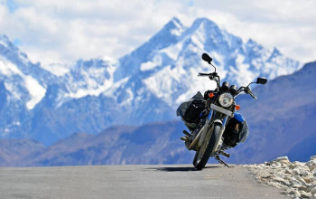
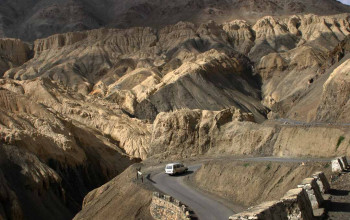
Pangong Tso can be reached in a five-hour drive from Leh, most of it on a rough and dramatic mountain road. The road crosses the villages of Shey and Gya and traverses the Chang La, where army sentries and a small teahouse greet visitors. The road down from Chang La leads through Tangste and other smaller villages, crossing river called Pagal Naala or "The Crazy Stream". The spectacular lakeside is open during the tourist season, from May to September.
An Inner Line Permit is required to visit the lake as it lies on the Sino-Indian Line of Actual Control. While Indian nationals can obtain individual permits, others must have group permits (with a minimum of three persons) accompanied by an accredited guide; the tourist office in Leh issues the permits for a small fee. For security reasons, India does not permit boating.


